The History of the River Calder
From ancient rock to industrial revolution, the River Calder has shaped this landscape, and the communities within it, for millions of years.

From ancient rock to industrial revolution, the River Calder has shaped this landscape, and the communities within it, for millions of years.
The rocks which underlie the Calder catchment were formed around 310 million years ago in the Upper Carboniferous period. On the high Pennines, the rocks are mostly millstone grit, consisting of sandstones and mudstones. To the east of Halifax and around the western extreme of the catchment at Todmorden, we see younger coal measures, where coal seams can be found among the mudstones.
These rocks were laid down by the actions of rivers ebbing and flowing millions of years ago, depositing silt and sand particles in thick layers when the rivers slowed down, and thinner layers when the flow was faster. Clay particles settling in lakes and swamps between the rivers created the mudstones. In the warm and wet climate of Britain 310 million years ago, the area which is now Calderdale would have been covered in a lush tropical rainforest. Dead plant material falling into the swampy ground gradually decayed and became buried by mud and sand as the rivers changed course over time. As more and more deposits were laid down, the water, oxygen and hydrogen were driven out under immense pressure, leaving only the carbon which formed the coal seams we see today.
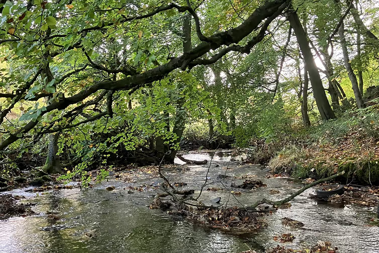
These mudstone and sandstone layers are slippery and soft. The action of the rivers on these soft layers over several millions of years has carved out the steep-sided valleys characteristic of the Calder catchment. Because of the slippery layers of rock, landslides are common, and this has shaped the way that the valleys of the Calder and its tributaries look today.
The place names around the Calder catchment can tell us about the early landscape and the people who inhabited the area thousands of years ago. Like many English river names, the name of the Calder itself is probably one of the only remnants of the Old Celtic language left in the landscape. The name "Calder" means "hard water" or "rapid stream", suggesting a rocky, fast-flowing watercourse. Similarly, "Colne" comes from the Old Celtic word for stony river.
The place names in the Calder catchment tell us about the different groups of people who lived there. We can see evidence of Roman settlement in Castleford (the ford by the Roman fort). Lots of place names have Old English roots, like Mytholmroyd (the clearing at the river mouths) or Holmfirth (sparse woodland associated with the River Holme), which come from Anglo-Saxon settlers who arrived in the area around the fifth century. Later Viking settlement is shown in names like Ravensthorpe (outlying farmstead or hamlet of a man called Hrafn) or Slaithwaite (clearing where timber was felled), coming from the Old Norse language.
Place names also capture some of the people and activities on the banks of the Calder, Colne, and Holme over a thousand years ago, referring to owners of farmsteads, timber clearance, cultivation, and the species which found habitats here: rose hips and brambles, woodcocks, and the land itself — stony ground, high ground, valleys and mud all feature in Calder catchment place names.
Industry has been hugely influential in shaping Calderdale. One of the very earliest fulling mills in the country was built at Sowerby Bridge in around 1290, carrying out a process in which fibres are cleaned and beaten to make them softer, stronger, and better for use in cloth making. Calderdale clothmakers specialised in a type of cloth called "Kersey", known for being hard-wearing and good value. By 1475, the Calderdale area had become the largest producer of this type of cloth in England.
Cloth production was so integral to the local economy that a special statute of 1555 allowed small wool dealers and middlemen to continue working in their own homes in the area, even as the practice was banned elsewhere. From the late eighteenth century, improved transport links led to an explosion in the cloth industry and in the population of towns like Halifax. As Daniel Defoe wrote in 1724: "and so nearer we came to Halifax we found the houses thicker and the villages greater... if we knocked at the door of any of the master manufacturers we presently saw a house full of lusty fellows, some at the dye vat, some dressing the cloth, some in the loom."
This began to change in the nineteenth century as the hand loom and system of home working began to be replaced by large scale mills and factories. The fast flow of the River Calder made it ideal for powering mills, and weirs were used to control both flow and depth to ensure that waterwheels could be kept running. Nineteenth century industrialisation also saw the creation of the canal system, and advances in technology saw ever more powerful milling machinery driven by water, controlled by dams, weirs, sluices, and gates — followed by the introduction of steam.
This has given us many of the mill and factory buildings and workers' cottages which characterise the countryside around the River Calder today. It also had a dramatic impact on living conditions, with small, cramped accommodation for rapidly expanding populations leading to unhygienic conditions, lack of clean water, and rapid spread of disease. The need for clean water for these growing communities led to the construction of reservoirs in the hills, while reformers began work on model villages to tackle the most serious deprivations of industrial life.
The expansion of industry in Calderdale was supported by a series of turnpike roads along the valley bottom, replacing the hillside packhorse tracks and dramatically reducing travel time between the Calderdale sheep farms, mills, and major commercial centres.
Perhaps the greatest agent for change in Calderdale's landscape came in 1770 with the completion of the Calder and Hebble Navigation. Further cuts and sections followed: the Salterhebble branch in 1828, and the Rochdale Canal in 1804. Joseph Priestley's Historical Account of the Navigable Rivers, Canals and Railways of Great Britain, published in 1831, described the transformation: "The country through which it passes has also partaken of the great advantages arising from a well regulated navigation. Agricultural lime has, by its means, been carried to fertilize a sterile and mountainous district; stone and flag quarries have been opened in its vicinity, which have furnished inexhaustible supplies for the London Market."
The canal continued to be used commercially until 1981, having undergone numerous new cuts, weir bypasses, and lock constructions over the course of its two hundred year history.
Calderdale and the surrounding areas have been shaped by flooding. The steep, narrow valleys mean that this has always been a risk. The earliest flood on record in Calderdale occurred in 1615 and destroyed Elland Bridge, which had already been rebuilt in stone after repeated flooding, only to be rebuilt again in 1617.
From 1830 to 1895, twenty-two serious floods were recorded in Calderdale, likely reflecting both better record keeping and the impact of industrial changes in and around the river. In 1837, flooding in Hebden Bridge reached nine feet in places. Almost twenty years later, in 1855, Todmorden was visited by what was described as one of the largest floods within living memory, with water at Mytholm reaching the same height as 1837. The 1860s were described as a decade "in which it never stopped raining", causing numerous floods throughout the Calder valley.
Flooding resumed through the twentieth century, with a particularly severe event in September 1946. From Brighouse to Todmorden, 905 properties were affected, a bitter blow after the deprivations of war. The twenty-first century has seen several major flood incidents, including severe flooding in 2000, 2012, and 2015, which saw record high water levels and an unprecedented number of homes and businesses inundated. Similar devastation followed Storm Ciara in 2020, which damaged at least 695 homes and 572 businesses, as well as roads, bridges, and infrastructure.
The series of severe floods from 2012 onwards prompted the formation of the Calderdale Flood Recovery and Resilience Programme, bringing together partners from across the water and environment sectors. Since 2016, a Calderdale Flood Action Plan has incorporated Flood Risk Reduction Schemes, Natural Flood Management schemes, and Flood Alleviation Schemes at Mytholmroyd, Hebden Bridge, and Brighouse.


Sign up to our mailing list for the latest news, updates, opportunities and more.
Our sustainable approach
At Calder Rivers Trust, we believe that sustainable design isn’t just a choice, it is an obligation. The health of our natural world is at the heart of everything we do, and that includes our digital footprint. Our approach to building our website reflects our commitment to a world where both our rivers and our climate can thrive.
By using compressed images, simplified code, and optimised content, we ensure our online presence aligns with our mission to protect nature. Through these practices, we have kept our environmental impact to a minimum.
Impact: Our homepage produces just 0.12g of CO₂ per page load.
Performance: This makes our site cleaner than 71% of all web pages tested globally.
Measurement: We track our footprint using Website Carbon, which calculates footprints based on data transfer, energy use, and the carbon intensity of the electricity used.